 |

Submitted by , posted on 08 August 2001
|
 |

Image Description, by

Hi everyone,
I run a 3D Visualization portal site at 3dvis.siliconthoughts.com and have
gotten a few e-mails asking what I am doing in Urban Visualization.
I am currently working with the RealSite modeling group in producing a
real-time visualization tool for the urban models/terrain that they generate.
RealSite allows us to semi-autonomously generate large-scale geospatially
accurate
urban models, and makes use of either aerial or satellite photography for
modeling
and texturing. We also have the ability to apply hand-held photography to the
extracted buildings for even higher resolution textures.
These models can be saved in a variety of formats, and imported into production
tools such as 3D Studio Max, and VRML viewers.
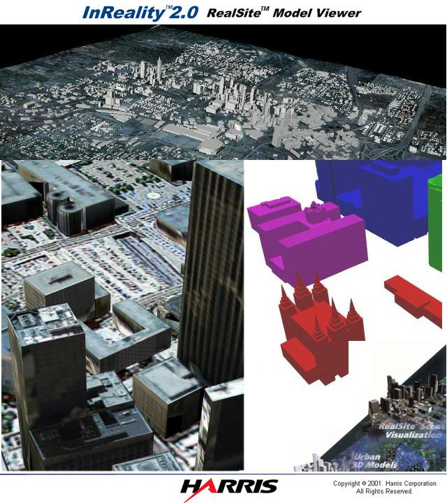
A few partial screen shots from the viewer can be seen above. The upper center
picture shows the extent of the models that we can create. This is an overview
of downtown Atlanta with a textured terrain. The bottom right shot is a close
up
view of some of the architecture we can extract. This is an example from the
city of Salt Lake, Utah, and shows a spired building in the foreground. The
bottom left shot is a capture of a fully textured Atlanta model. The textures
in this case came from aerial photography.
The InReality viewer provides the user an intuitive interface to navigate within
the environment, and create animated flythrough. The user is also able to
perform
tasks such as mensuration, and line of sight analysis.
For larger pictures of these sites, along with more detailed models visit the
following links. I'll be putting up information about this project along with
the other ones I have worked on at my web-site in the next few weeks after I
get back from SIGGRAPH.
tim@siliconthoughts.com
RealSite/InReality Information:
http://www.govcomm.harris.com/realsite/
http://www.govcomm.harris.com/realsite/3dmodels.html
http://www.govcomm.harris.com/realsite/SanDiego.html
realsite@harris.com
|
|

