 |

Submitted by , posted on 12 April 2001
|
 |
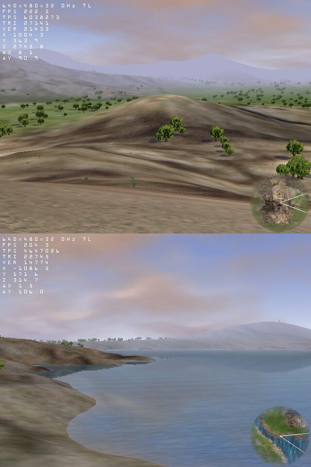
Image Description, by

The terrain size is 16 kilometers by 16 kilometers and the far plane is
located 5 kilometers away of the camera. This map has more than 100,000
plants.
The terrain is a simple quadtree rendered using static LOD. The plants close
to the camera are pre-lighted models with 2 LOD, when they are far away they
are draw as impostors depending of the angle with the camera.
The water is simulated using 2 quads with the texture tiling and moving in
opposite directions. The water reflection is rendered to a texture than
later is blended with the water applying a vertical blur.
The Sky is formed by a semi-sphere with a gradient of color from white to
blue than is blended with a clouds texture that fades to the fog color in
the distance.
For more screenshots:
http://rt000s2p.eresmas.net/photo.htm
http://usuarios.tripod.es/davidgaleano/photo.htm (Mirror)
Also, there is a demo available for downloading where you can see more
effects that those I have described:
http://rt000s2p.eresmas.net/downloads.htm
http://usuarios.tripod.es/davidgaleano/downloads.htm (Mirror)
|
|