 |

Submitted by , posted on 11 April 2005
|
 |

Image Description, by

On Wednesday, April 6th, I found out about googles new beta mapping
service from this Yahoo news article. I loved this tool, but thought I
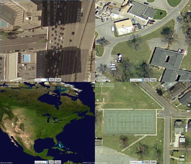
could improve on a few things. With that, I present to you my version
of a 2D GIS ortho viewer over the internet. Its my first program in
Java (started learning it Wednesday), but I think its relatively
feature complete. Everything was written from scratch, and its a brand
new algorithm I developed during my sleepless nights. Here it is for
your viewing pleasure : http://www.xl3d.com/
As for technology details :
It uses a dynamically growing quadtree to house the near infinite
resolutions. This means that you can throw in a very low resolution
image with an extremely high resolution image and not lose any pixel
accuracy when you zoom into the high resolution subset. There is still
a little shakyness when you zoom into the low resolution imagery, but
this wasn't an issue to me so I never bothered to fix it. Its only
there because I don't have the disk space to upload bigger imagery.
The quad tree automatically adjusts and frees itself to your viewing
position, such that you're never wasting unncessary memory.
Each raster is treated separately. This method is specific to 2D only,
but it works pretty nicely. Because each one is separate, we can
toggle them on/off as well as apply blending/swiping between the
different layers to give true GIS functionality. It should scale very
well for thousands of images as well.
The loaded raster resolutions in pixels are :
16,252 x 18,362
7,964 x 11,258
4,320 x 2160
Big by todays graphics card standards, but small by GIS standards. I
wish I could upload more higher resolution imagery, but I am limited
by my webhost. The current scene takes up a little over 130Mb
compressed on the website as it is.
More info is available in the write up on the applet page.
-Lennox
|
|

